About the Book
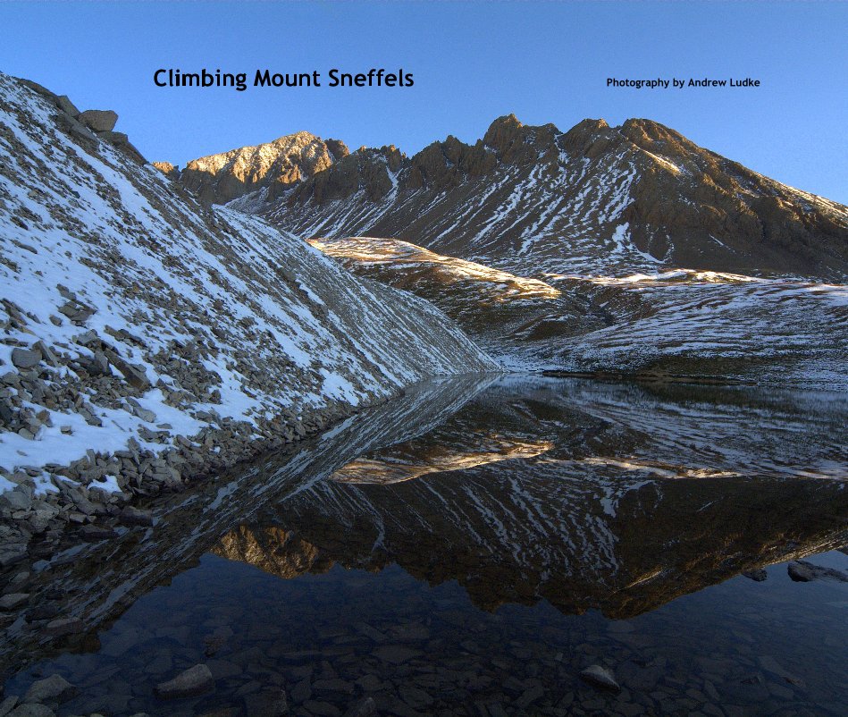
Mount Sneffels
Photography by Andrew Ludke
At 14,158 feet it's the 27th Highest Peak in Colorado
The summit of Mount Sneffels is the highest point in Ouray County Colorado. It is located in the Mount Sneffels Wilderness of the northern San Juan Mountains, outside the town of Ouray.
The primary route to the summit follows a creek bed up from Yankee Boy Basin, this however was our descent route. A secondary route follows a ridge line to the summit from the saddle of Blue Lakes Pass. We ascended along the more exposed ridgeline.
Mount Sneffels was named after the volcano Snæfells, which is located on the tip of the Snæfellsnes peninsula in Iceland. An area on the western flank of Mount Sneffels gives the appearance of a volcanic crater.
Mount Sneffels is one of the most photographed mountains in Colorado.
Latitude/Longitude (WGS84)
38° 0' N; 107° 48' W
38.003776, -107.79227 (Dec Deg)
254835E 4209914N Zone 13 (UTM)
Route
Scramble
Trailhead: Camp Bird Road 10,600 ft/3231 m
Vertical Gain: 3550 ft/1082 m
Features & Details
- Primary Category: Sports & Adventure
-
Project Option: Large Format Landscape, 13×11 in, 33×28 cm
# of Pages: 78 - Publish Date: Dec 26, 2008
See More
About the Creator

Andrew Ludke
Milford, PA